The starting point

The starting point

Friday, 16 December 2016

16/12/16 Been a bit slack , so here's the goss !!

 We’ve travelled again , catching up with my brother at Stuarts Point , south of Macksville .  After a quick 9 holes of golf at Coffs Harbour with Mark , we packed & headed off , arriving before lunch .
 After no power for a few days , we have ended up with a few loads of washing to be done , fortunately for us the weather was beautiful , so everything was washed & dried in no time at all . We checked out the jetty at the park , with a view to having a paddle in the morning . Black swans like this stretch of water - there were 20 of them - here’s some of them .


 After a good night’s sleep we were up early and after some breakfast we headed down to the jetty and hit the water . We paddled in The Macleay Arm section of the Macleay River , which stretch’s  from Grassy Head back down to South West Rocks . We didn’t paddle that far , instead we went round to the end at Grassy Head and then back to Stuart’s Point footbridge and return , approx 9klms . It is salt water , so has lot’s of mangroves , weed and shallow sections , but is teeming with fish and birdlife - here’s some pics .


 The tide was on it’s way out , so we discovered when we got to the footbridge , floating underneath it in the current , the realisation that we had to paddle against it sank in pretty quick !!! It was only flowing faster there due to the narrow section near the footbridge , and eased up a bit as we got further away from the bridge , thankfully !!


  We spent the afternoon talking & catching up with Gordon . We missed Meredith , she was in Canberra for family Xmas catchup . Sorry we missed you Meredith !!
After another good sleep , we headed over to Grassy Head and went for a walk along the beach toward Stuarts Point . The beach stretches off into the distance for about 5 or 6 kilometres . The hills on the horizon are near South West Rocks & Smokey Cape .


 Time to hit the road again and head off to Wingham , to catch up with Maree & Kevin ( sister & her husband ) . Stopping in Taree for some shopping and lunch , we continued on to Wingham and parked down at The Brush . The Brush is a remnant section of rainforest , that houses a large population of flying foxes , and is located beside the Manning River , there’s also a boat ramp , it’s a very popular area and well used by the locals and visitors alike !! This is our view of the river .


 We set up where we wanted , as we were the only ones there , before going to Maree & Kevins , where we stayed till about 9pm . 
  With water right beside us like this , there was only one thing to do - get out and get paddling - we seem to be doing this a bit of late , must be making up for lost time while we were up north & over west !! 
 Reflections were pretty good again, the wind not annoying us till later . We glided past the old wharf - used many years ago as a base to transport goods further down to Taree and beyond .


 The Brush made a nice back drop for the van & ute .


Continuing up the river , we passed under the bridge to Tinonee and kept going . Houses are built on the top of The Bight , and have great views down over the river and the farm lands on the other side . 


A bit further up is a house , seemingly perched on the side of the hill with even better views of the river .


 We paddled further up , deciding we needed to get out and stretch our legs , we chose this rock in the middle of the river !!


 It was getting pretty hot , so we headed back down the river . The temperature got up to about 42 today - that’s hot enough .


 Back to the van , we slid the kayak up the bank and dropped into the water and sat cooling off for about half an hour !!  We cleaned the kayak , had some lunch , before retiring back to the river again for another cool down . 
  We had another swim later with Maree & Kevin , before we had some tea with them .
 The flying foxes are well known for their mass departure flight from the brush on dusk , tonight was no different as they flew down to the river for a drink and then head off for the night finding whatever food they can find . It was also full moon , adding to the display .


Thursday, 8 December 2016

8/12/16 Catchup

 Hi there , we are in Coffs Harbour at the moment , we left Murwillumbah on Tuesday after one of the loudest thunderstorms we've had the pleasure of being in . It was around 4-5am when it stuck . With each lightning bolt came the thunder - as it crashed and banged , then echoed all through the valley around us - we could hear each thunder clap 6 to 7 times , and there were plenty of them .
 As a sad note , a young man was killed when a tree was hit by lightning on Mt Warning - it fell on him ?? details are a bit sketchy , apparently he was camping up there , his lady friend was also injured.
        It also bucketed down rain , we packed after the rain had stopped and headed off , leaving around 10:30am , and only got some light rain on the way down to Coffs Harbour . We caught up with Mark , who we'd been parked beside in Moss Vale prior to us starting our trip .
 Coffs had rain yesterday as well , so we shopped and wandered around the shopping centre's for some entertainment .
 Today we took care of a few jobs and went for a walk around Coffs Harbour Creek , before having dinner with Mark .
 That's it , all up to date , here are some photo's from Murwillumbah .


Monday, 5 December 2016

2&4/12/16 paddling & walks

 2/12/16

   With another blue sky day , where else would you want to be on a hot day but on the water again . Reflection Warning : - here we go again !!


  With so many options available to paddle , we tried a few before finding our final spot - Oxley River. We went to Stotts Island , but couldn't find a spot to put in safely , and it was very windy there as well , back to Rous River , same problem , so headed back out towards Uki and the bridge over the Tweed River - we could put in there !!
 So we did , under the road bridge and up about 40m was another creek/river joining the Tweed - it was the Oxley River , so we headed up there not knowing how far we could get . The river twisted & turned through pastures & sugarcane , we got some strange looks from the cattle .


 We found a low bridge going over the river , and thought our journey would stop . However ,we managed to paddle through and kept going .


 AS we went further , the river narrowed and we found more gravel beds instead of the grass & trees . A small set of rapids stopped our progress - we weren't interested in dragging the kayak up the shallow rapids and go into the next area , so we stopped in the shade and decided to have a sit in the river and give the hundreds of small fish something new to swim around . And swim around us they did - we had stirred all the rocks and gravel up as we got in the water , and in doing so stirred up a lot of their food in the rocks . There were tiny fresh water shrimp , the tiniest flathead I've ever seen - it was about 25mm long , and many hundreds of tiny fish from 10mm long to 50mm long !!


 This was taken from under the water - just playing around !!


 Mt Warning seems to be in the picture quite regularly here , doesn't seem to matter where you are , you will find it on the horizon somewhere .


 While paddling , the phone rang , by the time we got to it , it had rung out . It then rang again , Garry & Robyn had stopped for some breakfast and saw our ute , so we paddled back and had a chat to them for an hour or so .
   Everything had dried , so we packed up and headed back to the van for some lunch and a quiet afternoon - it was 33 degrees , but the sea breeze had started to come in helping to keep the temperature more manageable .
 Here's a map link :- https://drive.google.com/open?id=1JlFdZM0lU5SnJe5LINgaJeUAa7A&usp=sharing
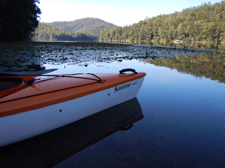


4/12/16


  Saturday was another hot day , so we just chilled for the day !!

 Sunday , we headed back to Queensland again , there are so many options to drive from here - you can go through to Natural Bridge & Springbrook ; out to Tweed Heads ; through to Currumbin ; through to Tallebudgera . They all involve driving up & over some mountains ( except for Tweed Heads - depending on which way you go !! ) .
 We headed over toward Currumbin , views back down the valley toward Murwillumbah were good  - there were a couple of opportunities to stop and look .


 We stopped at a couple on the Qld side , but one had overgrown trees blocking the view and the other had powerlines running through and over it .
 Getting down to the bottom of the valley on the Qld side , we were given a choice , left to Mt Cougall section of Springbrook NP , or right toward Burleigh and Currumbin . We went left of course , there was a sign to a rock pool and the NP , and thought the rock pool would be great for a swim maybe . It was only 4klms up the road , which seemed to take longer than average - maybe it was the narrow winding road ?
 Arrived at the pool , but there were many cars there already , so we kept going to the NP - it was another 6klms up the road . There are lots of houses up in the valley and there was also a reasonable sized school just past the rock pool .
 We got to the end of the road and there we were , many cars here also , but there were a couple of vacant spots , so we pulled into one , grabbed our water , the camera and headed off . The track up to the remains of an old sawmill is a bitumen track , and has a few information signs on the way up - it was only about 1 klm up .
 The walk is beside the beginnings of Currumbin Creek , with fresh clear water running between plunge pools and small waterfalls , all in a rainforest environment - a sea of green .


 Arriving at the top of the walk , there is a shelter shed built over the old remnants of the timber mill .


  A small track took us down to the creek and some small pools .


 Heading back down , we stopped at one of the pools popular for cooling off in the heat .


 I scrambled down the rocks , watching some guys jumping off the rocks above into one pool - about a 5m plunge !!


 Anywhere there was pool of water , there were people in them - this would be a great spot during the week when school is in !!
  We were ready to head off , so I put the camera down for a second whilst putting the backpack on , and click !!


  Back to the ute , we drove to Burleigh and then had lunch before heading for home .
Here's another map link :- https://drive.google.com/open?id=1SBCSVZAKy0y_OpBbCLq9VAQ5HDM&usp=sharing

Thursday, 1 December 2016

1/12/16 Clarrie Hall Dam paddle

Today we’ll start things off a bit back to front , here’s yesterdays sunset after the storm .


   We got some rain , nowhere near what they were getting up in the hills & mountains though !!

  It was paddle time , with the Tweed & Rous Rivers , and a few dams to choose from , it was a matter of where to go . We were up at 7am and had breakfast and headed toward the small village of Uki . Just past Uki is the turnoff to  Clarrie Hall Dam - it is water catchment for town use , but they do allow boating - canoes , kayaks , rowboats , but no petrol outboard motors - you can use electric motors though - you cant swim in the dam - so care must be taken not to capsize !! 

 Now I will warn you upfront , if you don’t like reflections , change pages right now !!! Cause here they come .


 It is such a beautiful place to paddle in , not too wide - but there are some big expanses of water - pristine rainforest covering the hills all the way down to the water .  Mist coming off the water , water lillies line the edges of the dam - more yellow than purple and some small frilly white ones , then there’s the aqautic weed that has small white flowers that forms another band beside the water lillies . dead trees , rocks & grassed areas , then there are a few houses thrown into the mix as well !!!
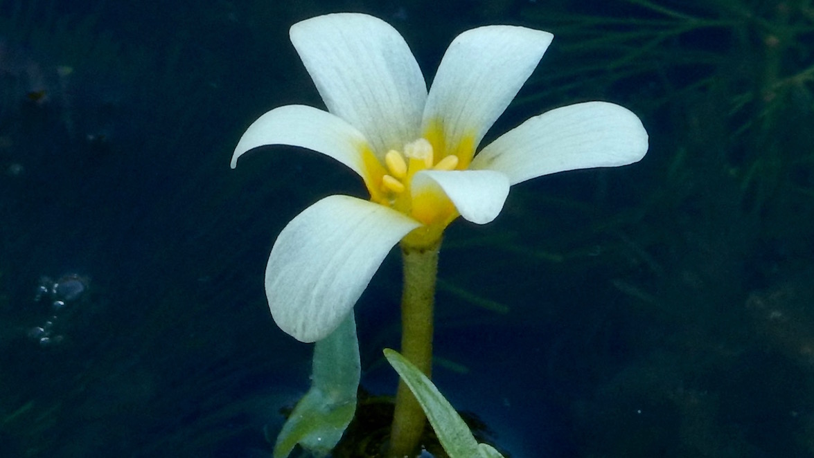


 It was getting quite warm , with very little shade to get some relief from the sun - it was 30 degrees but we were getting the first of the sea breeze , which helped cool things a little . We did a lap around Snake Island and came back to the boat ramp . Surprisingly , we had been paddling for about 3 hours , and covered about 9klms , possibly more with our zig zagging all around the place .


   Back for lunch and a relax in the shade of some large camphor laurel trees for an hour or 2 . Storms had been forecast for today , it was interesting to watch it all develop over the ranges behind us . 
 This cloud was developing over the scenic rim area to the west of us .


 The grey cloud came from further southwest , straight over Mt Warning and then us .


 This cloud went straight over us and headed toward Tweed Heads .


 All the fuss and bother , and we didn’t get very much rain out of it . However , it did regroup and approached from the northwest , dropping a lot of rain , thunder and lightning . It then cleared and we ended up with sunshine - what a day !!