The starting point

The starting point

Sunday, 2 February 2020

2/2/20 More of Albany


 Some more of Albany with some finer weather happening for us . We went out to Torndirrup NP again , this photo from the bird is looking toward the peninsular , the buildings at the end of the beach are the whaling museum .


  This is looking at the suburb of Goode Beach , Albany is across the bay to the right .


  This is from from Marine Dr Lookout looking across the bay to Goode Beach & Torndirrup Peninsular , the entry into Albany harbour is to the right .


  A few more days have been spent out at Two Peoples Bay NR - we love this place . The 2 rocks in the photo stand about 20m tall , and the split between them is about 3m wide .


  After a hike up the track that leads around to Little Beach , we got this spectacular view of Two Peoples Bay . The 2 rocks from the previous photo are there , centre of photo above the trees .


  Between that lookout and Little Beach are some great expanses of granite rocks , some trapping pools of water .


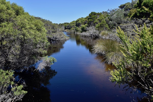
On the way into Two Peoples Bay , you cross over a creek that feeds into - or out of Lake Gardner . This is it , and Lake Gardner isn't easily accessible , and we don't fancy bush bashing our way in through this swampy snake infested area .


  Back to views of Little Beach .


  We had a quick swim & snorkel at Waterfall Beach in some cool crisp southern ocean water , thankfully it was a warm day outside .


   Back out to Torndirrup NP again and checked out a road we'd driven past many times , and thinking it was a typical 4wd access sandy track ,   we hadn't been down it . Today however we found a gravel road that anyone could drive their normal car down , the road led us out to Sharpe Point . We are starting to fill in all the missing pieces of a jigsaw puzzle here - most of the pieces are coming together . This is the view back to the Gap and Natural Bridge , the lighthouse is slightly further around toward Cable Beach .


 Some plants are still flowering , this one standing out from a sea of green shrubbery .


  Views from the lookout were stunning . Sharpe Point is just that , a sharp point - check it out on the map .


  This one is looking toward Albany wind farm and Cosy Corner & West Cape Howe  ( a few of the places we've been to ).


  This is looking back toward Frenchmans Bay , across the harbour to Two Peoples bay and the last hazy mountain is Manypeaks .


 Just a little note about this area , quite a large amount was burnt out a few years ago , apart from the few dead trees still standing , it has regenerated beautifully .


Tuesday, 28 January 2020

28/1/20 More around Albany


  Time has been passing by , the weather hasn't been the greatest - but we won't complain too much , as it's much hotter just about everywhere other than Albany . We've had some drizzly rain , wind and more wind - we've had temps from 12 overnight to 23 max during the days . 
 Enough of that , we headed out for a drive to Goode Beach , a suburb of Albany about 20 minutes drive out to Torndirrup NP . In between showers we got this photo at Frenchmans Bay , looking toward the old Whaling Station , now a museum . 


This photo however is Misery Beach in Torndirrup NP .


 Plenty of new growth here , this is a Banksia .


 Still in Torndirrup is Salmon Pool - a great fishing spot apparently , also extremely dangerous for rock fishing - many people have lost their lives here .


  This photo is Jimmy Newells Lookout - he apparently took shelter here in his boat from a vicious storm - he survived .


   Still plenty of wildflowers about , here's a couple .


 The rest of the day was cold & windy , so not too much was done .
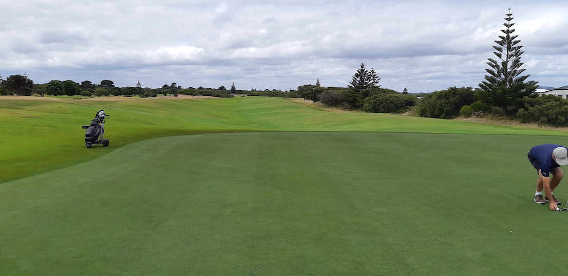
 Saturday rolled in and I decided to play golf , Albany Golf Club was once rated in the Top 100 public golf courses in Australia , it still is quite challenging , especially if you're not hitting the ball straightish - there's lot's of ball eating scrub lining the fairways . This is one of the fairways that has scrub down one side only . The fairways have been formed on the existing sand dunes , and accordingly , there is a lot of ups & downs and walking on different angles on this course . It is supposed to be just like the original links courses in Scotland . The golf wasn't great , but I ended up with a nearest the pin prize and a couple of birdies , finished with 33 points .


 Another day and another drive out to Nanarup Inlet , which is east of Albany . There's a tidal lake that doesn't always flow out to sea and a haven for bird life when the winds not blowing . It's lined with tea trees & coastal scrub .


 This is out on the beach , looking to what looks like a small island , but it's joined by a sand spit , and it hides a nice little bay - more of that soon .


  This is looking the other way , the mountains are part of Two Peoples Bay NR , one of our favourite places here .


  Walking up the beach and past the island revealed a superb small sheltered beach , and on the other headland a set of steps that we went up for this view of the beach looking back toward the inlet .


 It was also the perfect opportunity to let the bird have a fly , so here is the view above the island looking back to the inlet .


 This view is toward the next beach to the west - Ben Dearg Beach.


  This is also that beach with a couple of the islands that are in front of Frenchmans Bay - the entrance to Albany from the ocean . Torndirrup NP is on the right hand side in the distance .


  The colours in the cliff beside the small beach were impressive for their variety .


  The sun came out again a few days later , so we headed up the road a bit to see the chainsaw sculptures - it's a bit different in that it is a drive through gallery . Most of the sculptures are cut out of tree stumps & trunks . It is a place that needs to be seen - there's carvings of eagles , owls , cockatoos & kookaburra's , people & animals . You are also asked to make a donation , which is quite reasonable given there's over 60 different sculptures . Here are just a few . Peakaboo .


 Grizzly Adams & his bear .


 A rhino's head .


 Found a gum tree out in blossom on the drive home .


  Another day we headed north toward the Porongorups Mountains about half an hour away . Now it was going to be one of those drives where you look at the gps and see a road to the right that will take us through the back blocks , then you proceed to zigzag right & left , back and across , up & down . The weather was a bit iffy again , with intermittent showers and overcast . We didn't mind though as we were seeing more of the countryside . There are plenty of pine and eucalyptus plantations around this way , and I like the way the trees are all lined up .


  The Kalgan River flows down to Oyster Harbour before going into the ocean - we came across it on our drive .


  We eventually came out onto the highway near Manypeaks - a small village , but in usual fashion we were no sooner onto the highway , then we were off it again until we couldn't find any more side roads to go on .
  This is King River , it's also about 20m away from the van , so not such a bad view .


  That's an update for you , here's the map link : - https://drive.google.com/open?id=1IWqp7O4ahUO7K2YyR_yPoFPaq3oU6Y2T&usp=sharing


Wednesday, 15 January 2020

15/1/20 Repair reprieve


  Leaving our lakeside camp spot , we headed into Katanning for some fuel , before heading south to Cranbrook where we stayed last year . The drive took us past some of the salt lakes that I flew over last year - not so impressive when they are dry though . 
  Continuing on we had to go out to the Albany Hwy to Mt Barker , where we stopped for lunch in a warm 34 degrees . We got going again and about 30 kms out we found another free camp for the night near Narrikup Cricket Club Ground . The ground has a boundary fence and a part of that fence is made of old cricket bats - makes for a good looking fence !


   After a quiet night , we made our way into Albany , staying at a park about 9klms out of town , we had a couple of nights there before the van went in for repairs . They even had a spare house for us to rent for the night - no cabins were available , but they charged us the same amount - lovely people !
 Fortunately the van was ready next afternoon - and yes - it's fixed yahoo !!! So with that we thought we'd support the park and stay for another week . 
   As it was a nice day , we headed out to Two Peoples Bay NP . Little Beach is a spectacular spot , beautiful clear water and white sand , a few granite rocks thrown in . Unfortunately for us , a lot of other people have also found out about it - the carpark was overflowing , but we got there as someone was leaving - score . 
 This is the view from the path down to the beach - Stunning !


  At the far end of the beach is a granite outcrop , and over the other side of this outcrop is another beach - Waterfall Beach - it too is stunning as well . There was a group of young men playing beach cricket there as well as a few other people enjoying the beauty .


  The waterfall was just a trickle over a rock , running down onto the sand and into the ocean . The view is across to Mt Manypeaks .


    Incredibly clear water and sandy bottom , rocks seem to be just sitting in the water enjoying the day .


 After enjoying the beauty for an hour or more , we made our way back to the van . 
Having plenty of time , we are enjoying not rushing around filling every available minute with something to do or see . We are spending our spare time catching up on jobs that need doing , finding that there are a few things that need some more attention than others - one of our roof vent fans needed replacing as well - back to town to find they had one in stock , have to be happy with that .
 A few days later we headed up to Mt Clarence and the remembrance drive , parked at the top and were going to go for a walk up to the top monument , but found a circuit track leading off the bottom of the carpark , so decided to take that instead . It turned into a 3klm walk down a lot of steps , then an access track beside a water pipeline , then a track back up to the top again , quite a pleasant walk . The track also went past some housing , not for long though - this is looking west toward the wind farm .


  This is looking further to the north , Albany is a spread out city , with many more houses etc round to the right of photo .


  This is part of the harbour , probably had a lot to do with Albany being the first settlement in WA . The dock area is just out of picture bottom right - past the wood chip piles . A cruise ship was in port today as well , adding a few thousand people into town .


  Our weather has been varied , usually windy , sometimes overcast - more so over the last week or so  temperatures have been struggling to get past 22 degrees - I know , everyone over east is saying we'll have that please , overnight has been getting down to 12 - we are wearing jackets during the day !!
  Time to go for a drive , we headed west toward Denmark , but along the old road rather than the main road . First stop was East Mutton Bird Beach and Shelter Rock . The photo from the lookout shows the beach and Shelter Rock to the left . Straight ahead and to the left is West Cape Howe - the southern most point of WA - Cosy Corner is also straight ahead on the other side of the bay .


   This is the view as you go down the path to the beach , to the sheltered stretch of water beside the island .


  This is the beach complete with orange rocks .


 The bird came out for a fly - check out the colour of the water - and today is full overcast ,


  One side of the island is calm , the other waves crashing onto rocks .


  This is Shelter Island looking back toward the Torndirrup Peninsular NP.


   Leaving here we called in to a few other spots , but most were out in the wind , so we didn't stop long there , but found a lot of Christmas Trees with these orange flowers .
 

  Around to Cosy Corner Beach , stopping under all these very old tea trees , branches have been twisted and contorted into some weird shapes .


 This is Migo Island


 Around further into West Cape Howe NP to Shelley Beach - this was taken from the lookout and hang gliding and paragliding take off . Landing spot is down on the beach in front of the grassy area - also a camp site .


  The left hand end of the beach is protected by these huge granite boulders .


   Kangaroo Paw is out in flower everywhere around here at the moment , predominantly this colour .


  This is the view from a track beside the road down to the beach , spectacular scenery .


  This photo is Sheeley Beach Rd and is a beautiful section of Karri forest .


 There you are , up to date again , here's map link :- https://drive.google.com/open?id=12rJwSQWF1WuMJZSBiQpG5_JbRBs8A8lp&usp=sharing