The starting point

The starting point

Monday, 5 December 2016

2&4/12/16 paddling & walks

 2/12/16

   With another blue sky day , where else would you want to be on a hot day but on the water again . Reflection Warning : - here we go again !!


  With so many options available to paddle , we tried a few before finding our final spot - Oxley River. We went to Stotts Island , but couldn't find a spot to put in safely , and it was very windy there as well , back to Rous River , same problem , so headed back out towards Uki and the bridge over the Tweed River - we could put in there !!
 So we did , under the road bridge and up about 40m was another creek/river joining the Tweed - it was the Oxley River , so we headed up there not knowing how far we could get . The river twisted & turned through pastures & sugarcane , we got some strange looks from the cattle .


 We found a low bridge going over the river , and thought our journey would stop . However ,we managed to paddle through and kept going .


 AS we went further , the river narrowed and we found more gravel beds instead of the grass & trees . A small set of rapids stopped our progress - we weren't interested in dragging the kayak up the shallow rapids and go into the next area , so we stopped in the shade and decided to have a sit in the river and give the hundreds of small fish something new to swim around . And swim around us they did - we had stirred all the rocks and gravel up as we got in the water , and in doing so stirred up a lot of their food in the rocks . There were tiny fresh water shrimp , the tiniest flathead I've ever seen - it was about 25mm long , and many hundreds of tiny fish from 10mm long to 50mm long !!


 This was taken from under the water - just playing around !!


 Mt Warning seems to be in the picture quite regularly here , doesn't seem to matter where you are , you will find it on the horizon somewhere .


 While paddling , the phone rang , by the time we got to it , it had rung out . It then rang again , Garry & Robyn had stopped for some breakfast and saw our ute , so we paddled back and had a chat to them for an hour or so .
   Everything had dried , so we packed up and headed back to the van for some lunch and a quiet afternoon - it was 33 degrees , but the sea breeze had started to come in helping to keep the temperature more manageable .
 Here's a map link :- https://drive.google.com/open?id=1JlFdZM0lU5SnJe5LINgaJeUAa7A&usp=sharing


4/12/16


  Saturday was another hot day , so we just chilled for the day !!

 Sunday , we headed back to Queensland again , there are so many options to drive from here - you can go through to Natural Bridge & Springbrook ; out to Tweed Heads ; through to Currumbin ; through to Tallebudgera . They all involve driving up & over some mountains ( except for Tweed Heads - depending on which way you go !! ) .
 We headed over toward Currumbin , views back down the valley toward Murwillumbah were good  - there were a couple of opportunities to stop and look .


 We stopped at a couple on the Qld side , but one had overgrown trees blocking the view and the other had powerlines running through and over it .
 Getting down to the bottom of the valley on the Qld side , we were given a choice , left to Mt Cougall section of Springbrook NP , or right toward Burleigh and Currumbin . We went left of course , there was a sign to a rock pool and the NP , and thought the rock pool would be great for a swim maybe . It was only 4klms up the road , which seemed to take longer than average - maybe it was the narrow winding road ?
 Arrived at the pool , but there were many cars there already , so we kept going to the NP - it was another 6klms up the road . There are lots of houses up in the valley and there was also a reasonable sized school just past the rock pool .
 We got to the end of the road and there we were , many cars here also , but there were a couple of vacant spots , so we pulled into one , grabbed our water , the camera and headed off . The track up to the remains of an old sawmill is a bitumen track , and has a few information signs on the way up - it was only about 1 klm up .
 The walk is beside the beginnings of Currumbin Creek , with fresh clear water running between plunge pools and small waterfalls , all in a rainforest environment - a sea of green .


 Arriving at the top of the walk , there is a shelter shed built over the old remnants of the timber mill .


  A small track took us down to the creek and some small pools .


 Heading back down , we stopped at one of the pools popular for cooling off in the heat .


 I scrambled down the rocks , watching some guys jumping off the rocks above into one pool - about a 5m plunge !!


 Anywhere there was pool of water , there were people in them - this would be a great spot during the week when school is in !!
  We were ready to head off , so I put the camera down for a second whilst putting the backpack on , and click !!


  Back to the ute , we drove to Burleigh and then had lunch before heading for home .
Here's another map link :- https://drive.google.com/open?id=1SBCSVZAKy0y_OpBbCLq9VAQ5HDM&usp=sharing

Thursday, 1 December 2016

1/12/16 Clarrie Hall Dam paddle

Today we’ll start things off a bit back to front , here’s yesterdays sunset after the storm .


   We got some rain , nowhere near what they were getting up in the hills & mountains though !!

  It was paddle time , with the Tweed & Rous Rivers , and a few dams to choose from , it was a matter of where to go . We were up at 7am and had breakfast and headed toward the small village of Uki . Just past Uki is the turnoff to  Clarrie Hall Dam - it is water catchment for town use , but they do allow boating - canoes , kayaks , rowboats , but no petrol outboard motors - you can use electric motors though - you cant swim in the dam - so care must be taken not to capsize !! 

 Now I will warn you upfront , if you don’t like reflections , change pages right now !!! Cause here they come .


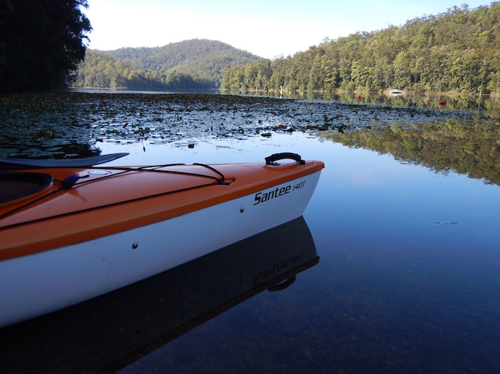
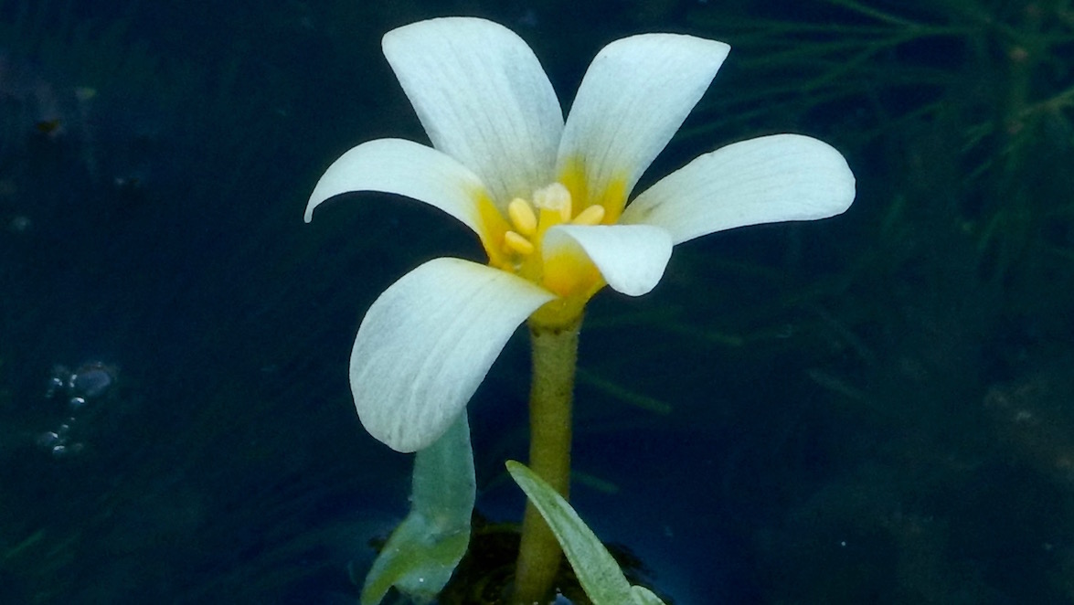
 It is such a beautiful place to paddle in , not too wide - but there are some big expanses of water - pristine rainforest covering the hills all the way down to the water .  Mist coming off the water , water lillies line the edges of the dam - more yellow than purple and some small frilly white ones , then there’s the aqautic weed that has small white flowers that forms another band beside the water lillies . dead trees , rocks & grassed areas , then there are a few houses thrown into the mix as well !!!


 It was getting quite warm , with very little shade to get some relief from the sun - it was 30 degrees but we were getting the first of the sea breeze , which helped cool things a little . We did a lap around Snake Island and came back to the boat ramp . Surprisingly , we had been paddling for about 3 hours , and covered about 9klms , possibly more with our zig zagging all around the place .


   Back for lunch and a relax in the shade of some large camphor laurel trees for an hour or 2 . Storms had been forecast for today , it was interesting to watch it all develop over the ranges behind us . 
 This cloud was developing over the scenic rim area to the west of us .


 The grey cloud came from further southwest , straight over Mt Warning and then us .


 This cloud went straight over us and headed toward Tweed Heads .


 All the fuss and bother , and we didn’t get very much rain out of it . However , it did regroup and approached from the northwest , dropping a lot of rain , thunder and lightning . It then cleared and we ended up with sunshine - what a day !!


Tuesday, 29 November 2016

29/11/16 Cabarita Beach

   Another short drive today , shopping needed to be done and we went to a few supermarkets today , some good , some not so good . A few things we normally get , were more than double the normal price we pay - that was a bit rude !! We were a little blinded by a 10% discount voucher at the local IGA - it was given to us by the show ground , and while we don't mind spending money locally - we don't like being ripped off either !!
 Rant over , we went for a drive out to the coast again , this time a little further south , to Cabarita Beach . The drive took us through cane fields , up & down hills , past streams & creeks - a nice drive.
 After doing a little bit of shopping , we drove down to Norris Headland which separates Cabarita Beach from Casuarina Beach . Both beach's stretch into the distance north & south , there's also a smaller beach beside the headland , lucky to be 200m long .

Cabarita Beach

The short Cabarita Beach and Casuarina Beach

  Cabarita Beach from Norris Headland 

 We wandered up the boardwalk to the headland , stopping for a photo & then just sitting and watching the ocean .


  Going back down , there was a young sea eagle perched on a bare pandanus branch , chewing on a fish recently captured .


 Getting back to the beach , we walked along it and up the steps back to the ute , then having lunch in the Lions Park .


  Taking another road back was a treat as well , we went along Round Mountain Rd , which brought us back to Murwillumbah , again up & down hills , winding our way through valleys back to the sugarcane again .
 Only a quick blog today , here's a map link :-https://drive.google.com/open?id=1oB2VxYEPRgTRMn89k3mGQSSxI3Q&usp=sharing


Monday, 28 November 2016

28/11/16 Fingal Head

 Getting used to the quiet here & catching up on some sleep again . We get up and check out our view of Mt Warning .


 Today we’re heading off to Fingal Beach to have a look , as we’ve never been here in all our visits to the Gold Coast . It was only about 30 klms away , so didn’t take too long to get there . Pulling up at the carpark beside the surf club , we wandered down to the beach , doing the hot sand shuffle till we got to the wet sand . There’s a good stretch of white sand going all the way up to the Tweed River entrance and some form of ship loading facility ??? maybe sand ???? who knows !! 


 The beach also went further south to the headland , which also has the lighthouse and the Giants Causeway .


 Cook Island is also close to the coastline .


 The walk along the beach also finished our drive back to the east coast as we dipped our toes in the Pacific Ocean .
  There were a few BlueBottles washed up on the beach - they’re called Blue Bottles for a reason .


Heading back to the ute , we checked out some of the houses , many have been renovated or knocked down & rebuilt  . It’s a great location , ocean one side and the Tweed River on the other .
 We found our way up to the lighthouse and took lunch with us , finding a seat under some of the pandanus trees . It was hot away from the breeze , but fortunately it kept us cool as we ate lunch . We also had company for lunch - a pod of about 30 dolphins decided to keep us amused swimming back & forth in front of us .


 Lunch complete , we found a bearded dragon on the way down to Giants Causeway . 


The Giants Causeway is a part of the headland that has nearly been cut off . It was formed when lava from the volcano cooled slowly , forming these basalt columns . The volcano , by the way was centred at Mt Warning - that is the remnant core of the volcano !! 


 Walking around the headland , we checked out the view over Dreamtime Beach towards Kingscliff , before having a look at one of the most insignificant lighthouses we’ve seen 


 Making our way back home , we looped around to Terranora and went down the other side of the Tweed River back to Murwillumbah . We found a nice lookout over the river and out to the ocean .