The starting point

The starting point

Sunday 25 February 2018

23/2/18 Back to the top 2

  Well after yesterday , what will today hold for us ?? Barrington Tops was pretty good , so how will Gloucester Tops fare ??
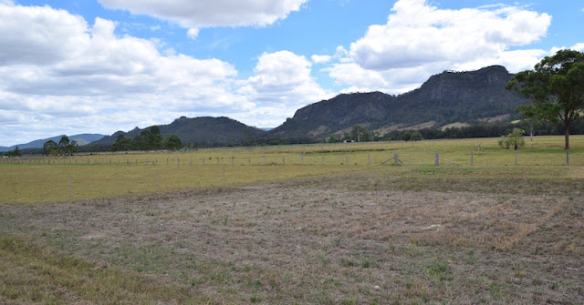
  A slower start to the day , but we got going checking out the Buccan Buccans on the way out from the sportsground park , then a bit closer .


 The Gloucester River is our companion today with lots of spots for photo’s to be taken , these are just a few .


A similar drive to yesterday , 6 causeways to cross , farmland giving way to dense untouched forests , and one continuous climb up the mountain to Gloucester Tops .


Today we went to the end of the road to the river walk - the upper reaches of Gloucester River - the walk took you alongside but up above the river , access to the river wasn’t there .


 Snowgums are predominate on the plateau areas but there are other trees as well - some of which have the most interesting bark .


  There are a few flowering plants - very small flowers , these being not much bigger than 5mm across .


 Scribbly gums are here as well , love the patterns - some of the bugs had a lot to say !!


  Gloucester Falls was a pleasant surprise , I had to scamper down a track to the edge of the river to get to see it though , as the lookout was obscured by the trees below now getting too high and blocking the view . 


 Further around is Andrew Laurie Lookout , looking back to the east .


 It was a completely different day today , the temperature was higher and the walk was quite warm untill we got around to the lookout - the cool southerly breeze coming up from down below was a welcome relief . 
 Back to the ute , we headed back to the Beech Forest Walk - there were 2 options - a short walk for about 30 mins or the 1.5hr version , we chose the short walk . The Antarctic Beech trees were taller here , but not as dense as yesterday , the ground was carpeted in ferns & tree ferns , parrots , wrens & fantails were going about their business not really worried by us .


 After a few hundred metres we came across a stream , it flowed down over the moss covered rocks in 2 separate streams - straight off a postcard !! Absolutely beautiful !!


 Dragging ourselves away , we completed the walk , what a magnificient place - somewhere I would recommend to everyone to see . we got back to the ute and drove home completely satisfied with our short visit to Barrington & Gloucester Tops - definitely worthy of it’s World Heritage Listing .

Saturday 24 February 2018

22/2/18 To the Top

 Barrington Tops is somewhere we’ve wanted to go to for some time - the opportunity has arrived today . 
 Lunch sorted , ute packed with jumpers & jackets , we hit the road - out to Barrington & across the single lane bridge , then turn off the road up to Walcha toward Copeland Tops .


 Our drive was through rolling hills , grazing & dairy country before getting steep and covered in forest , then back down the other side to more grazing country beside the Barrington River again . This is the river as it makes it’s way out of the mountains through sheoak lined banks and round river rocks , water is very clear . 


 A flowering plant - probably a weed caught my eye .


 After crossing the river a few times we arrived at the base of the mountain and started to climb rapidly - eventually getting us up to 1500m asl - it snows up here and weather can change rapidly . It was 24 degrees when we left and was 14 degrees up on top - something we aren’t quite used to any more !! The drive up was beautiful , through gum trees , vines , grass trees and lots of tree ferns .


 Stopping at Honeysuckle , we went for a walk through the Antarctic Beech Forest . Beside the road were everlasting daisies flowering .


 The walk takes you through the gum tree forest and onto the southern side of the mountain into a world of green - moss covers nearly everything here , doesn’t matter if it’s standing or lying on the ground , old trees lay decaying in the moss & leaf litter - I’ll let the photo’s do the talking .


 We came across a Lyrebird scratching around in the leaf litter .


The beech trees are amazing shapes and sizes - we saw one like a gridiron goal post , branches are draped in ferns that live on air - it’s a magical place to visit .


 Back in the ute and further up the road was Thunderbolt’s Lookout with views over the forested hills & valleys to the south & east .


 Even the rocks seem to be growing moss & lichens like they are turbo charged .


From here we continued to Devils Hole Lookout , which is very similar to Thunderbolt’s looking over the same areas , so we headed off to Poleblue swamp for some lunch .
Down the road some more and there’s a plantation of Douglas Fir trees that were planted in the 1950’s - quite a sight , it’s only about 200m wide but it’s difficult to see the outer edge untill you are about 20m from it . Douglas Fir trees are used as Oregon timber .


 On the western side of the Barrington Tops National Park is Dingo Gate , and another view to the west & southwest , and Snowgums are the dominant trees .


 Next destination was Poleblue Falls , on Poleblue Creek - we were prepared for there to be not too much water flowing , as the surrounding areas have been extremely dry with very little rain falling . We were surprised when we saw the falls .


 On the map we had , there was a loop road that would bring us back around to Honeysuckle walk , so we headed down the track . It was a little narrow and a bit rougher , but it was also taking us to another waterfall - Gummi Falls , it’s also a camping area for tents and maybe campertrailers - no vans here !! Turning off the track to go to Gummi Falls , the track is rougher and narrow and is a slow trip in . The other interesting fact for us was that this is the Manning River - very near it’s source !! Anyway , here’s the falls , some white everlasting daisies and shots of the river .


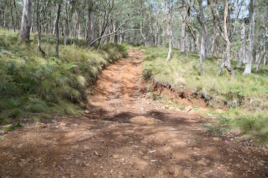
 The track continued on and met the main rd - Scone Rd , so we headed off up the track - Lyn was driving - and the track started to head uphill after a couple of creek crossings - 4WD was engaged , the track was rutted , uphill , some boggy sections and loose rocks - low range was selected and we crept up & over the hill , rocks & ruts . This was the start of the climb and one of the rutted sections , I didn’t take photo’s because I was out directing Lyn !!


 4WD all finished , one relieved driver , and we were back on the road heading down the mountain back to town - what a good day !!! 

Friday 23 February 2018

21/2/18 Off to Gloucester

 After a week at Blackhead playing golf and catching up with Alan & Di , we leave the coast and head inland a little . Gloucester is our destination for a few days . Arriving in town we are impressed with the sporting fields & parkland & pool all together in one picturesque setting beside the Gloucester River .  
 All set up , we headed back into town to get some information on the surrounding areas - Barrington Tops , Gloucester Tops and the Buccan Buccans ( that is the name of the rocky outcrops to the west of town . After chatting to the information staff for 10 mins , we were off to do a tour around the Buccan Buccans .


  Heading out the road toward Barrington , we spotted a sign for Kia Ora Lookout , so away we went . Crossing over the Barrington River for the 1st time , we then climbed to the top of a hill with several towers on it . 


Views were 360 degrees , this is looking back over town to the south and the 2nd photo is looking to the northwest .


  Back on our loop drive around the Buccan Buccans , we drove through Barrington township , crossing the river again on a single lane historic timber bridge . Turning off that road to the south through rolling hills beside the Barrington River , we get to cross it again , at a causeway this time - good fun !!


 This is the view back to the north .


 More river crossings , this time it’s the Gloucester River .


  This is the southern part of the drive with a close up look at the massive rocks that are the Buccan Buccans .


Another river crossing or 2 and we were back in town , had a look at the river - very low & not much flow , this was us parked on the river gravel bed about a metre above the water level .