After all our work , we decided to head west of Kempsey for a drive , just because we could ! Another nice day , we headed down the old highway down toward Frederickton . Crossing the Clybucca Creek , I asked my driver to stop and turn around for a photo opportunity . The reflections in the water were perfect , clouds were reflected in the creek and there was some blue smoke hanging around as well .
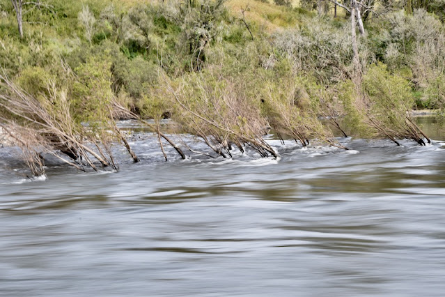
The destination for today was Hickeys Creek , but we stopped early and went down to the Macleay river and Toorooka Bridge . The river was flowing well and the water was surprisingly , very clear - I expected the water to be a little brown with all the rain falling of late .
Guess which way the water flows ?
It was time for a drone flight to show off the river valley .
From here we decided to go up to Bellbrook to check out the village . The road was down to one lane beside a large landslide that would have closed the road - there were 2 x 40ft sea containers being used as a blocking wall to hold back the land slide . We drove through Bellbrook , turned around and came back to a spot with views over the river , so we stopped for lunch .
Yes it's Lantana , but it's also a pretty little flower .
This grass seed got my attention as well .
The drone came out again for a look around .
This is the landslide , if you zoom in , you can see an excavator down at the bottom and the 2 x sea containers further up , just to get an idea off the size .
After lunch we headed back to Hickeys Creek Rd , the bitumen ended after a bit and we were back to the back roads again . Love the forests around here . The road took us through forests and open areas , creeks flowing well and water seeping out of nearly everything , it was a great drive .
Crossed over several bridges , with creeks flowing well .
Finding ourselves at Taylors Arm , we found another road which would take us on a short cut - finding this patch of forest .
The rain started and we continued on as the track slowly got narrower and wetter , with many boggy sections to go through . We bailed out , turned around after reversing for about 500m and headed back to Macksville then back to Stuarts Point . We would have continued if it was dry - that's our excuse anyway .
Here's a map link :- https://www.google.com/maps/d/edit?mid=1guz1x1lr8r10H155t4gLYUMmPNsMebk&usp=sharing


No comments:
Post a Comment