The starting point

The starting point

Monday, 4 December 2023

30/11/23 Peppermint Grove Beach


  Whilst in Bunbury , we headed down the coast to a great little spot called Peppermint Grove Beach . There's a small village , but the beach is excellent , with very few waves so nice and easy for swimming . Here's a few of the locals enjoying the beach , when we arrived there was only 3 other people and 2 dogs using the beach - fine by us !!


    There's a playground , Bbq's and picnic tables - not a bad view .


   Here's a couple of aerial shots showing our beach off .


   Beautiful spot !!


    After some beach walks and a swim , we had lunch beside the playground , then headed up to the lookout . About 120 steps up to the top got the heart rate up sufficiently .


 360 degree views from the top looking all the way round Geographe Bay to Dunsborough .


   And north up to Bunbury 


   An excellent day out , we headed back north to the van . Here's a map link :- https://www.google.com/maps/d/edit?mid=1iQ72Rdxu6I33pqe1HhWWIlIkIYT-qCw&usp=sharing


29/11/23 Bunbury , Collie River


      From Jarrahdale we headed south to Pinjarra , so we could catch up with Emma and get a parcel we were waiting for . It was good to see her and we had a reasonably quiet night . 

   Next day we headed off to Bunbury where will will stay for a couple of weeks . The drive was uneventful - which is always good !! Finding ourselves at Australind at 10:30am , and not being able to check in till 12noon , we stopped at a nice park to while away some time while we waited . There's an interesting sculpture further down in the park , that we wandered down to . It has indigenous input , and represents the area , food sources etc . Looks like it's all been laser cut and assembled - it is impressive !


    The following photos are around the Collie River , from the bike tracks that we covered a lot of .


    The Christmas Bush is out in flower again and looks great . There were several large trees of them along the rivers edges .


    Another view of Collie River and the bike track .


   We swam , rode our bikes and did some shopping in the crazy sales for some things we required , and generally relaxed - we're a little bit lost at the moment after our time in the goldfields - if only it wasn't so hot out there we would probably still be there !! Here's a map link :- https://www.google.com/maps/d/edit?mid=1w9ziMhlGTt4vz2JWORWQj2O0eI5I0SM&usp=sharing


18/11/23 Jarrahdale


  Moved down to Jarrahdale , up on the Darling Scarp (ridgeline that runs for quite a distance from north of Perth to past Bunbury ) . We stayed at the free camp they provide for 3 nights . It is beside what was a timber mill . The forest around here is quite nice with lots of Jarrah forest . Trails lead into the bush from the campsite , here's what it looks like .


       There are some small buildings as well , fenced off now , but these were the single mens accomodation , with a communal ablutions block beside them . Shame they are starting to fall apart .


   Still , they are in a beautiful setting .


    Not far from those huts is the old mill , it was one of the newer mills that was electrified . The roof is falling in now , but this structure is where the timber was stacked after being cut . The centre is a large turntable that turns to allow the cut timber to be stacked in the appropriate section , then removed for stockpiling outside .


  Here's an unloading / loading crane in the yard .


   They loved their belts & pulleys .


   There are thousands of wattle trees reclaiming the areas around the old mill . You can understand why there are so many when you see how many seeds they produce . Here's just a small section of one tree !!


    Even though it's past spring , there are still some wildflowers to be found.


    And of course there's hundreds of grass trees around as well , flower spikes pointing skyward .


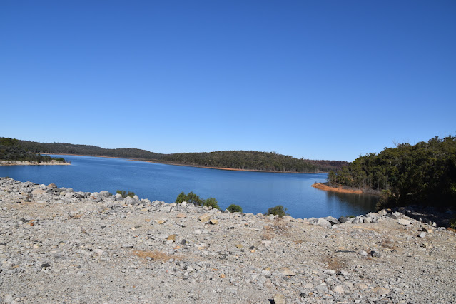
    We headed down to Serpentine Dam one afternoon , it's a bit neglected when compared to other dams in the area . This is a close as you can get to the edge of the dam wall - you can still drive across and there's a parking area on the southern side , so you can walk to have a look . The dam is fairly full at the moment .

    We visited Terry & Robyn another day before moving on further south . Here's a map link :- https://www.google.com/maps/d/edit?mid=19X4FXKjW7nRRTNIESZrN5zDeYg8_rEY&usp=sharing

Saturday, 18 November 2023

11/11 Lake Ninan


    Leaving Baladjie this morning we head west again , fortunately the wind is blowing from the east again so we have a tailwind again . We would have been staying put if going east , the wind was very strong - too strong to drive into . 

   This is all wheat country and the fields go on and on and on . They stretch from one horizon to the other , not all are being used for wheat , some are being rested this year but will be used again next season . The road isn't excessively wide , so it was really pleasant that we didn't get much traffic at all . 


    The road took us through some great towns - Boodarockin , Warralakin , Mukinbudin , Barbalin ,Welbungin and Bencubbin before Koorda and Cadoux , before we knew it we were at Wongan Hills and a little further out of town to Lake Ninan , yeap another salt lake !!
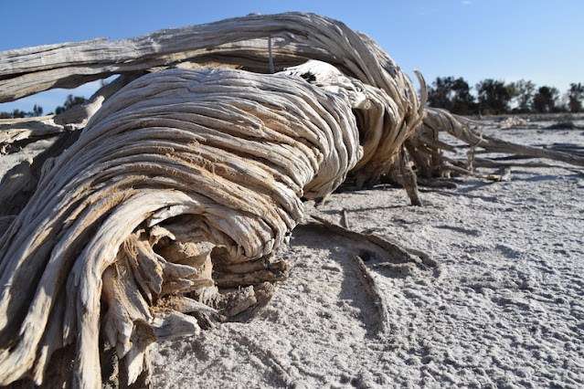
   This one has an enormous amount of driftwood / tree stumps on it's edges near the camp area - here's just a few of them .


    There are twisted and tortured , weathered bits of tree .


     They've mostly been killed by the rising salinity of the ground .


     A stark reminder of what can happen if too much land is cleared for agriculture .


     The lake provided us with the perfect backdrop for sunset .


    Tomorrow will see us heading back into Perth and lots of people - not sure we're ready for that yet , but we'll just have to be !! Her's a map link :- https://www.google.com/maps/d/edit?mid=1GbtDTTwPJOAyYMCS0b2R3382e_Bn3kk&usp=sharing


10/11 Baladjie Lake & Rock


     Leaving Lake Koorkoordine , we headed northwest for about 20klms to Bullfinch , a very small town , before starting our cruise west . About 20klms further , there was a turnoff to Baladjie Rock and Baladjie Lake , so we headed in for a look - that turned into another night . Arriving at the rock , we drove around a bit further and found an area that opened up , with plenty of spots to set up on - easily fit 30 or 40 vans here !! There was plenty of Mulla Mulla which was highlighted by the tiny yellow Everlasting Daisies .


    After lunch it was time to go for a walk up to the top of the rock , some 30 - 50m above us . Views from up on the rock are extensive 360 degrees , showing more of the salt lake system and surrounding wheat fields . I spotted some red tailed black cockatoo's in a gum tree a few hundred metres away .


     Various animals must cross backwards & forwards across the lake judging by the tracks .


    On the northwestern side of the rock , there's a curved bowl with it's own tiny forest . Rain flowing off the rock here would be spectacular to witness .


    There's another granite rock a kilometre or so away in a wheat field . If you can zoom in on the left side of that rock , in the wheat field you may be able to make out some emu's - there's about 30 of them !! about equal numbers of adult birds and young ones .


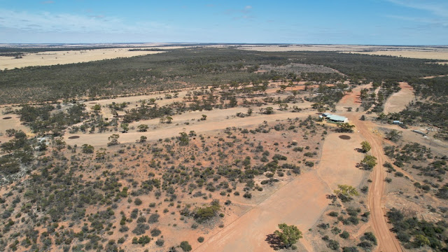
    Here's an aerial view of Baladjie Rock , it is quite large .


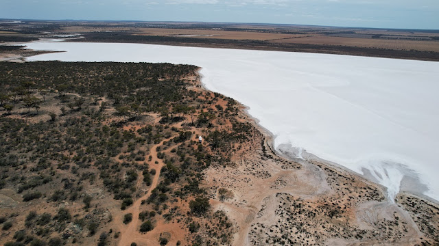
    And looking in the opposite direction is Baladjie Lake , you can spot our campsite there as well .


    The lake is piercingly white , it hurts your eyes .


    After an enjoyable climb and wander around the rock , that was it for the afternoon . 

9/11 Lake Koorkoordine


      Hitched up , we headed west along the highway to Southern Cross , with the intention of stopping there for a night or two . There's a great free camp beside a salt lake and the golf course , it's about 10klms out of town to the north . Arriving before lunch , we checked out the track in , a little tight and twisty but nothing we haven't seen before . We found a spot and set up , no-one was there , we had it to ourselves . Here's the view we have from the van .


    After lunch it was time for a walk down to and along the edge of Lake Koorkoordine . After the sand & rock came the crunchy salt , it cracked and crunched as we walked . Deciding to test it out , we headed out onto the lake and kept going until we thought we'd gone far enough . The salt was moist and it was like being at the beach with all the balls of sand being brought to the surface by the crabs . The surface was covered in similar balls of salt - but no crabs here . It was wet salt as well and stuck to your shoes / thongs getting heavier and heavier as we walked . Back to the side and a clean up of the soles of shoes .


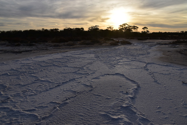
    Further along the lake edge was an inlet section , where water could flow in when enough rain fell . The salt there was busy growing and cracking , forming ridges and ripples in the surface .


    Sunset was upon us , turning the skies & lake into many different colours .


    Next morning the wind had dropped , so it was time to get some air . This is the golf clubhouse and a few of it's holes - yes it's a tad dry at the moment , the greens / browns are oiled sand .


   Here's part of the lake and where we parked . The railway from Perth to Kalgoorlie goes along the far side of the lake .
    

    Time to hit the road again , we had excellent winds for travelling west , so took advantage . Here's a map link :- https://www.google.com/maps/d/edit?mid=1tyaODvifz4KA97luD1gbUUON9fhlCXI&usp=sharing

Thursday, 16 November 2023

6/11 Kambalda & Coolgardie


    From Dundas we went to Kambalda West , to the free camp beside the sports complex , swimming pool & skate park . It's somewhere we've driven through before but never stopped . After setting up and having lunch , we drove over to Kambalda East for a look at the lake and township . It seems to be miners & their  families that live here . We drove up to the lookout to check out the lake and the mines . There are mines on the lake ,  gold and nickel mines . They're a bit hard to see , but in the middle of the photo there's a lot of workings , and digging going on . There's also more mines in the distance as well . There's a road system and power lines going across there lake , but the general public can't go there .


   Here's some of the man made islands in the lake , you can see the roadway and powerlines here .


     This lake disappears into the distance , just for scale , there's 2 trucks down on the lake surface just above the trees .


    After driving around town , we headed back to the van so we could go for a swim at the pool - bonus , it was free entry to everyone , thanks Coolgardie Shire Council. It got up to 39degrees today !!
    After a hot night , we packed up again and headed to Coolgardie again , setting up at free camp again , before heading off to do some more detecting . Trying some different spots , we found these tiny everlasting daisies 


     Weather forecasts weren't looking too great for the goldfields , so we made the decision to head back toward Perth , and call an end to our gold detecting season .

   Here's a map link :- https://www.google.com/maps/d/edit?mid=1NRt_911jDTzvvcjUMRBlkylURs7fbtA&usp=sharing