Another day another drive to familiar territory , we drove out past Pyramid Hill a couple of years ago and decided to do the road again , but in the opposite direction . The drive is out along the highway through Roebourne then onto Roebourne Wittenoom Rd and back to Warlu Way & back to Karratha .
Now for those that haven't seen the chocolate topped hills , here they are .
The road is in reasonably good condition after you get past Pyramid Station - it takes in quite a bit of this huge river valley we are driving through .
Here's a closer view of the rocks , they do resemble chocolate sauce being poured over the top .
Pyramid Hill was the next item that came into view after a bit more driving , it's 220m above sea level , so it's not small .
Back with the camera zoomed out gives you an idea of the size of this valley .
We stopped so the drone could come out an check this hill out , this view is looking into the valley towards Python Pool in Millstream Chichester NP .
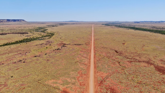
They don't muck around with corners in the roads up here , and you can see the 2 rivers each side of the road . Both are generally dry at this time of the year , but there will be some underground water - hence the tree lines .
Back into the ute and a drive toward Python Pool , you can see a track on the left , it takes you out to a remote campsite beside George River , we've yet to get out there , but the time will come .
I looked at this photo and wondered why I'd taken it then I realised there's a Spinifex Pigeon in there .
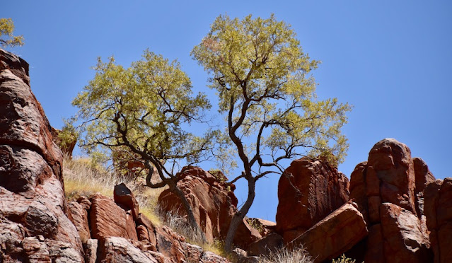
Down at the river - or what remains of the river , this tree stood out - it's in the rocks at the top of the ridge and has seed pods hanging from it , nothing else but seed pods .
This is the water hole in George River .
We headed around to Python Pool , and found several other cars there - much to our disappointment , but we went down with lunch , the water was a little green , fish were still swimming around in it , and other people were having a swim , and as it was 35 degrees , we decided to have a dip as well - keeping our heads well above the water line .
Lunch done and cooled off , we headed further up the road for some views of the valley we'd just driven through - what a great view .
Pyramid Hill can be seen in the distance top right of photo .
From here it was 10klms of gravel road back to the bitumen of Warlu Way . Now let me tell you , we've been on some pretty horrible roads all over Australia , but this 10klm stretch is deplorable , potholes & corrugations you could get lost in . A family had pulled up about 1klm in with their caravan in tow - I stopped and advised them of the road conditions and told then if they wanted to have a caravan left , they should park it here and drive on with the car only - they decided that would be a smart option .
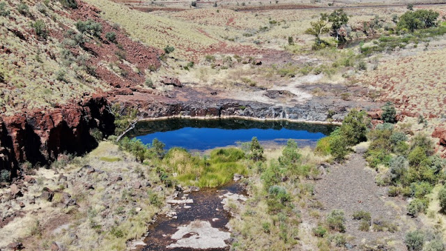
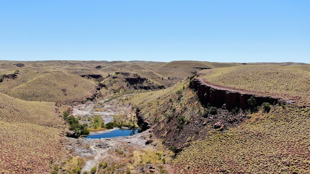
Back onto the bitumen and we started looking for a gorge that we'd found in Wiki Camps , but couldn't get to - it was only 400m away from the road , but is separated by the Rio Tinto railway line , anyway a drone soon sorted that problem out , and here it is - Red Dog Gorge .
It's more of a water hole below a small cliff in a valley eroded away by water and the elements for thousands of years .
The gorge is on the left hand side of the next photo that shows the twin rail lines , the road , and the water pipeline from Millstream to Karratha .
About 2klms up the road , we went under the railway bridge to the other side and found another spot called Goanna Leg Falls - I think the water fell and disappeared a long time ago , there were only a few puddles left , but here's a shot of the falls and surrounds .
This is from directly above .
Oops , those pesky people got in on the shot again 😁😂🤣
And that wraps up our time at Karratha , onwards and downwards again . Here's a map link : - https://www.google.com/maps/d/edit?mid=1OT13isb0rlU4CeXYwGTzcBU9YwkTeKn_&usp=sharing


No comments:
Post a Comment