
Here we are again , moved towns - because we couldn’t stay at Yea any longer - it’s booked out for this week .
Before we left we had a wander around the Wetlands beside the information centre . Reflections were at a premium in the bigger billabongs , the smaller ones were lucky to have any water in them.


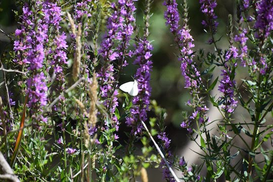
There’s lot’s of long grass and weeds at the moment , trees have fallen over in the creek and haven’t been removed , clogging the creek a bit . There was the odd spray of purple flowers for the white butterflies to feed on .
It seems to have had better days , and summer probably isn’t when it’s at it’s best , but we’re here now , so that’s what we’ve got !!


The Yea Creek flows through as well , it too , has a lot of trees down , giving the creek a grey tinge . There’s also a suspension bridge that crosses over the creek .


Back to the ute and into the main street to get a couple of things before heading back for lunch and a new kayak cover - the old one has seen better days !!
The main street is a wide spread street , with parking areas in the middle between the four lanes . There are many trees as well and some interesting buildings , a blend of old & new .

We are now at Seymour - 38 klms down the road - it sits beside the Goulburn River , which snakes it’s way around the town . It’s a bigger town , having Coles , Woolworths & Aldi supermarkets , not far away from Puckapunyal - an army base that occupies a square of land about 30 kms each side . It’s has a railway background , being on the main route to Sydney , and has been bypassed by the Hume Freeway .


Our park fronts the river , and there’s a nice water flow , it is cool though , must be the temperature it comes out of Lake Eildon !! We’re in amongst some river red gums with views of the river and park .

Today we headed out to Strath Creek , a little village in another beautiful valley .

We’re going to Strath Creek Falls , and it’s up the top of the hills so we had to wind our way up & down again . Murchison Gap Lookout is on the way offering views over “ The valley of a thousand hills “ It is spectacular !!

The trend of building houses on ridge tops is alive and well here as well , the driveway earth works would cost as much as the house !!

Back on the road , and it went to gravel , but still a good road . Going passed the national park sign , we hoped it wasn’t a premonition - “ Mount Disappointment National Park “ Further on was the turnoff , down a very steep road to the parking area . Seemed to be the theme , the track down to the viewing area was also steep - concrete steps were there to assist , and a safety fence so you don’t go sliding over the edge into a deep valley .

The falls , unfortunately , were not flowing - there was a trickle , but nothing more . The creek that feeds the falls comes out of the forest , joins another smaller creek beside the walkway down to the viewing areas .
In the valley near the falls is a wall of rock that looks like it’s been concreted , a nice level surface sloping down into the bottom of the valley . There’s also a pile of rock down the bottom where the layers of rock have dropped to .

There’s also a gum tree that juts out perpendicular to the rock face , this photo shows the rock face a little bit better .

Here’s another addition to my dragonfly collection .

A small pink flower was growing out from between some of the steps , only noticed it on the way back up . There’s also some plants that have flowered , and are past their best , but still looked good .


The map that we got from the information centre wasn’t terribly good , and Hema maps in the ute wasn’t showing some of the roads - some tracks had names that didn’t correspond with their map , so we went back & forth a bit , finally finding the track down to the old quartz kilns , where they used to separate the gold from the quartz . The track was single lane with bush encroaching both sides , dropoff one side and hill on the other - if we meet someone it will be flip a coin o see who gets to reverse out !!!
Unfortunately the photo didn’t really show the kiln off very well at all , so we won’t post that one . We continued on to Reedy Creek - apparently , according to the map , there was a creek crossing and it may be impassable !! After turning onto the right roads and finding the creek , we approached cautiously - we eased the front wheels in , then continued , the back wheels just flowed along over the gravel , and we drove across the relatively new concrete bridge - probably been here a few years - so much for the brochure !!!
Making our way into Broadford , we found a park and stopped for lunch . Not long after we sat down , a ute and trailer came down through the park and parked beside us , it was the graffiti removal team ( there was some work to do there !! ) He had come to clean the tables & chairs & Bbq up , ready for Australia Day . He did comment that this happened prior to Anzac Day as well !!
We left him with it and headed to the Pioneer Museum , about 200m away . There’s 4 buildings here - an old school house that has been moved to 3 different schools through it’s life , then there’s the old printers building from Broadford , an old slab hut with timber shingle roof - discovered in someones backyard when it was all cleaned up - they transported it to this site , and an old timber lockup ( jail ) . There’s a large silver ball and drive wheel , that we couldn’t figure out till we read the sign . Apparently they’re used to make paper out of straw & even old sails from sailing ships were used as well . This soaking ball was one in a bank of twelve in the paper mill .


Taking some backroads rather than the freeway back to Seymour gave us a look at some more of the countryside - it certainly had it’s summer coat on - parched , golden brown and dry as a chip !!
Further down the road is Tallarook , another small old town with hotel , mechanics institute , church and other old shops .


Down a few other minor roads and we found ourselves beside the Goulburn River on the western side of an old road bridge . It is officially a navigation hazard !!! if you are kayaking down the river , you have to get out of the river and carry your kayak / canoe to the other side of the bridge and then put back in to the river - not sure how many people would do that, but that would be the risk they would have to take !!!

That’s it , you’re up to date , here’s a map link : - https://drive.google.com/open?id=1ZcDmiSfjdVMaRSQK6t9LoiVY4g8&usp=sharing
No comments:
Post a Comment