The starting point

The starting point

Monday 26 February 2024

18/2/24 Fitzgerald River NP


    There ended up being 5 caravans , 1 camper trailer and 4 rooftop tenters as well as us at the free camp . Most had gone by the time we headed off . We were only 55 kms from Ravensthorpe , and made it there for a break and emptying the tanks . This mural is on a building near the new council chambers & visitors centre .


    We hadn't been back to Hopetuon since 2019 , so it seemed appropriate to revisit . Arriving in town , we made our way to the 48hr free camp area and found a spot we could just fit in beside the road - it was one of only 2 places we could fit !! 
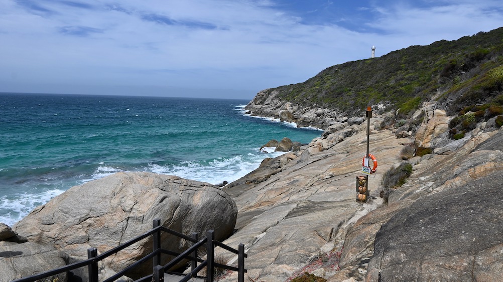
   After lunch , we headed out for a drive to Fitzgerald River NP stopping at Barren Beach for a walk .


    The beach is below East Mt Barren and has some great views along the coast .


    One of the features here is this area above the beach , the concrete represents the ocean and the edge of it is the coastline here at the NP. The stainless steel structures represent the mountains in the NP and each rock under the structures is a piece of rock from each mountain . Best way to view it is from above , so you'll have to look back to April 2019 blogs on our previous visit , and you might see a shot from above .


    Up from the beach we went to the lookout above the beach , looking back toward Hopetuon .


    The Royal Hakea grows down in this area , but not many other places other than this section of coastline . It's a really impressive bush , each years growth is usually a slightly different colour - not so much on this visit .


                                         This plant caught my eye , so here's a photo .


     Looking back up at East Mt Barren .


    An area they call the rock garden has these small shrubs looking like bonsai's .


   There were the odd few flowers around , even though it's late summer . If you can zoom in on the photo , this flower is quite amazing .


    Fires did a lot of damage to the NP late last year . If you look passed the road you can see the other side of the road has been burnt out .


   Here's the Royal Hakea flowers .


    Making our way up to Cave Point the following day , we found the flowers above and below .


    Cave Point is named by the caves below obviously - there's a lookout on the top of the ridge to the right.


    This is the other side of the point that you don't get to see - till now !!


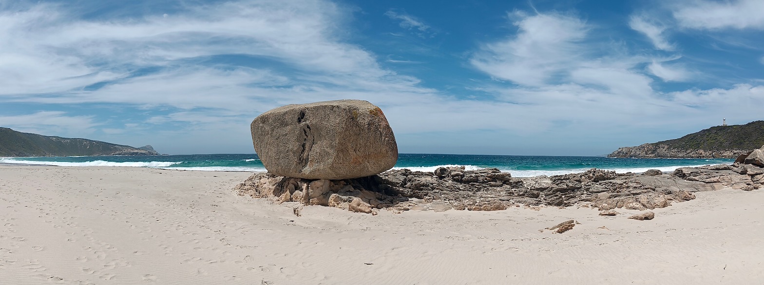
     The coast is rugged and dangerous , definitely not user friendly . This is beside West Beach.


    Here's West Beach , with a brave soul having a swim .


   Walking down from Cave Point was interesting , the track taking you down to the beach and all these striking rocks , poking out of the sand at interesting angles .


    We found a type of Banksia that was in all stages of flowering as we drove back out of West Beach . Here's a shot of it starting to come out .


    This one of it starting to open up 


    And this one towards the end of it's shelf life .


    The Royal Hakea's weren't this high when we were here last , and they show the yearly growth much better . They have turned into small trees , the ute giving some size comparison .


    Hammersley Inlet was the next stop , to our surprise it was full of water . Last time here it was barely a trickle of water in the middle . This is the remains of an old jetty .


    I mentioned the recent fires , this is some of the burnt our areas , interesting that some sections at the bottom of the valleys went untouched , and they managed to restrict the fires to this area , saving a lot of the NP from the fires . That is East Mt Barren in the distance .


     We called back in to 4 Mile Beach , just because we could .


     We moved out of the free camp and went to the caravan park at the tavern for 4 nights , so we could check things out at our leisure . Here's a map link :- https://www.google.com/maps/d/edit?mid=1VsDVCf_oLfz62PTQOrL3XGAO_vToruI&usp=sharing


17/2/24 Fitzgerald


    Albany is in the rear view mirror , and we are heading east . Finding a free camp along the way was a pleasure we couldn't resist . The old locality of Fitzgerald once had a school , it had a cricket / football oval out the back , which is now the free camp area . We were the 3rd vehicle in , pulling in and setting up before having some lunch . The oval is lined with gum trees and coarse white sand .


    The cricket pitch has seen better days and would be a harsh test of players dodging the dead tree at one end .


     The gums have been chewed pretty well by some hungry bugs , leaving interesting patterns .


    Aerial views of the area seemed to be the go , there's a lot of cropping here - wheat , barley , canola & lupins being grown here . This is the view over some of the small fields being used . The road is the South Coast Hwy and Fitzgerald Road intersection looking southeast toward Hopetuon .


                                                         Here's the highway looking west .


    And this one is the cricket oval , us parked on the LHS . The school was at the far end of the oval , the building at the right hand side of the oval is the old tennis club building . There were 3 bitumen tennis courts that are now slowly being reclaimed by nature . The clubhouse also had table tennis inside as well .
  The bare ground at the bottom of the photo is an area that has been graded to direct rain water into the 2 dams , which provide water to 2 tanks beside the oval for travelling stock .


    So there was more to Fitzgerald than meets the eye , here's a map link :- https://www.google.com/maps/d/edit?mid=1L_Nxyfw2BPk8CAJXRL7Wf_ozSEhdZLU&usp=sharing


Saturday 24 February 2024

15/2/24 Torndirrup NP


    Torndirrup Np is always a place to visit when in Albany , so that's where we headed . First stop was Cable Beach - very different from the Broome variety - but just as interesting . It starts with a walk over the granite rocks to the top of the stairs , then down a lot of steps to get to some more granite rocks down below .

    It's also a popular rock fishing spot , so there's rescue boys and ring to assist someone if they get swept in by rogue waves . There are even anchor points on the rocks so the fishermen/women can tie themselves to - that's a serious way to fish !!


    Visible from up at the top of the stairs is a rocky section with a large boulder perched on top . The rock is the size of a car .


    The rock shelf it's perched on top of , is a strip of limestone - very holey limestone at that ! It's also very sharp on the feet to walk on , so thongs or shoes are a good idea .


   The wind was pretty strong today , so the beach wasn't the best place to be , so we went out to The Gap and Natural Bridge . We've been here a few times , so I decided it would be a challenge to take photo's with a different view . Here's the view below the walkway - 37m above the water .


More stainless steel in this shot 


   This one is of the cantilever supports that support the platform above the gap . There are 30mm pins that go down into the rock 9m holding the beams securely in place .


    You can spot a couple of fishermen on the rocks in the distance , you can understand what would happen with a large wave crashing on the rocks , there's nothing to hold onto !! To each their own .


    Down to Frenchman Bay for some lunch , it was even better as it was sheltered from the winds - completely different day down here !!


     After some lunch we headed down the beach for a walk , discovering this concreted spring water access that was originally discovered by a Captain Vancouver . The spring was concreted to allow more permanent access to the fresh water . It was also very cold water !!


     Back in the ute and up to Salmon Holes - a very popular beach and rock fishing area - again another dangerous place to fish , many people have been swept off the rocks here .


     The Blowholes was our next stop , and another good walk downhill towards the water . Bushfires here in the last year have removed most of the vegetation on one side of the track down .


   It's good to see the regrowth sprouting everywhere - the bush is very resilient .


   The bitumen track gives way to a set of steps , burnt by fires to the right , but spared on the left . Everyone coming up was puffing and panting , complaining about the walk back up .

    We made it down to the blowholes , it was similar to when we were here last , a blast of air coming out of some cracks in the granite occasionally - it usually makes you jump . Apparently when it's in full flight , there's some water spray that comes up as well . It's remarkable that this occurs , as the split in the rocks is about 40-50m away from the water and about the same height above it . 

We headed back up to the ute , making it up the steps without all the huffing and puffing most others were doing - we were a bit surprised !!

   Back to the ute and back to the van , our time in Albany coming to a close . We have dodged all the heatwave happening north of us , which has been wonderful , but there's still more heat to come apparently . Here's a map link :- https://www.google.com/maps/d/edit?mid=1dostRVQeA2NOk3D_Mwh3l-2WWLXRD5U&usp=sharing

Thursday 22 February 2024

12/2/24 Albany


     Leaving Denmark , we head to Albany for a week staying at King River Palms CP . We were lucky ? enough to get a concrete slab in a section down close to the river with only 7 other vans - much quieter than the very busy upper section . We were camped next to a creek and this  - King River .


    Going for a drive , we saw a sign for the metal art trail , so decided to go for a look . The side road took us down to a driveway with a loop drive and an interesting array of metal sculptures / artworks . Here's a few of them - an old fan cover piranha 


    Stainless steel eagle 


   Another interesting piece .


    And probably our favourite , a Stainless Steel Eagle . They were all for sale too , pity we couldn't fit them in !


   From here we drove into Albany and around the port , before going around Marine Drive to a Lookout / carpark , looking out over the outer harbour and towards Flinders Peninsular Torndirrup NP .


     From there we went to Middleton Beach , got the bikes off and went for a ride around . This is the view towards Emu Point from the swimming enclosure jetty at Middleton Beach .


     Here's the shops/ restaurants and beach volleyball area at Middleton Beach .

   Here's a map link :- https://www.google.com/maps/d/edit?mid=147n3rFiOtcidbqkIdsiJyWuUYkk4xco&usp=sharing