There ended up being 5 caravans , 1 camper trailer and 4 rooftop tenters as well as us at the free camp . Most had gone by the time we headed off . We were only 55 kms from Ravensthorpe , and made it there for a break and emptying the tanks . This mural is on a building near the new council chambers & visitors centre .
We hadn't been back to Hopetuon since 2019 , so it seemed appropriate to revisit . Arriving in town , we made our way to the 48hr free camp area and found a spot we could just fit in beside the road - it was one of only 2 places we could fit !!
After lunch , we headed out for a drive to Fitzgerald River NP stopping at Barren Beach for a walk .
The beach is below East Mt Barren and has some great views along the coast .
One of the features here is this area above the beach , the concrete represents the ocean and the edge of it is the coastline here at the NP. The stainless steel structures represent the mountains in the NP and each rock under the structures is a piece of rock from each mountain . Best way to view it is from above , so you'll have to look back to April 2019 blogs on our previous visit , and you might see a shot from above .
Up from the beach we went to the lookout above the beach , looking back toward Hopetuon .
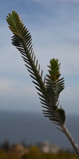
The Royal Hakea grows down in this area , but not many other places other than this section of coastline . It's a really impressive bush , each years growth is usually a slightly different colour - not so much on this visit .
This plant caught my eye , so here's a photo .
Looking back up at East Mt Barren .
An area they call the rock garden has these small shrubs looking like bonsai's .
There were the odd few flowers around , even though it's late summer . If you can zoom in on the photo , this flower is quite amazing .
Fires did a lot of damage to the NP late last year . If you look passed the road you can see the other side of the road has been burnt out .
Here's the Royal Hakea flowers .
Making our way up to Cave Point the following day , we found the flowers above and below .
Cave Point is named by the caves below obviously - there's a lookout on the top of the ridge to the right.
This is the other side of the point that you don't get to see - till now !!
The coast is rugged and dangerous , definitely not user friendly . This is beside West Beach.
Here's West Beach , with a brave soul having a swim .
Walking down from Cave Point was interesting , the track taking you down to the beach and all these striking rocks , poking out of the sand at interesting angles .
We found a type of Banksia that was in all stages of flowering as we drove back out of West Beach . Here's a shot of it starting to come out .
This one of it starting to open up
And this one towards the end of it's shelf life .
The Royal Hakea's weren't this high when we were here last , and they show the yearly growth much better . They have turned into small trees , the ute giving some size comparison .
Hammersley Inlet was the next stop , to our surprise it was full of water . Last time here it was barely a trickle of water in the middle . This is the remains of an old jetty .
I mentioned the recent fires , this is some of the burnt our areas , interesting that some sections at the bottom of the valleys went untouched , and they managed to restrict the fires to this area , saving a lot of the NP from the fires . That is East Mt Barren in the distance .
We called back in to 4 Mile Beach , just because we could .
We moved out of the free camp and went to the caravan park at the tavern for 4 nights , so we could check things out at our leisure . Here's a map link :- https://www.google.com/maps/d/edit?mid=1VsDVCf_oLfz62PTQOrL3XGAO_vToruI&usp=sharing


No comments:
Post a Comment