Today from Borroloola we head out to a very popular place - King Ash Bay - it's on the McArthur River . It's popular for it's fishing , in fact so popular that it's a fishing club . The club leases the land from the NT Government and has a full caravan park that you can stay at , it has areas for life members of the club , reserved sections for different fishing clubs eg Alice Springs Fishing Club , Tennant Creek Fishing Club etc . King Ash Bay is at the end of a 20klm dirt road , we drove in and had a look . The boat ramp was nuts , there were at least 40 cars & boat trailers parked there , a couple of small house boats were anchored in the river , and the caravan park seemed to be full . In the photo , the caravan park is at the end of the road and also goes around to the left of photo . An aerial view was called for .
This is looking in the other direction , you can see the dark area on the right , it has recently been burnt off .
The river has high banks on the edges , small cliffs really , gradually eroding away .
And a closer look .
From here we headed out to the port , now the name of the port is Bing Bong , we don't know why ? This is it , they deliver the lead & zinc oxide from the mine out to here in road trains . This is the excellent view from the viewing platform .
Fortunately , we drove around the plant and found a track to the beach where you can see what they do . The oxide is loaded into this barge / loading boat , which then takes it out to the waiting ships and offloads. They use this system because the gulf is very shallow here .
A drive along the small beach took us up to a sand spit where there are mangroves and this tree complete with nest - by the look of it , it's probably an Osprey nest .
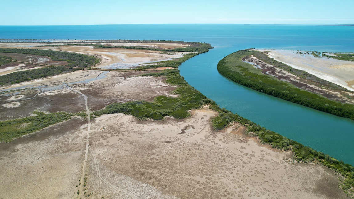
It wouldn't be complete without some aerial views , to give you a better idea what this coast line in The Gulf of Carpentaria looks like from above . The island at the top left is West Pellew Island , part of the Pellew Island Group . The islands are still inhabited by the local aborigines and some islands have restricted access .
This is the beach we drove along - you can see the port near the top of the photo .
That's the end of the sand spit we got to .
Apart from the tyre track marks in the sand , all the other tracks are made by animals - presumably cattle .
Back to a very corrugated road for a couple of kilometres and we were at Mule Creek boat ramp , where we had lunch .
Now for some aerial shots that I'm very impressed with - Mule Creek .
Just love how the photos have come up - spectacular country we live in !!
All the colours & patterns get revealed from above .
Another view of the Pellew Islands .
I know there's crocs about , but we dipped our toes in anyway .


No comments:
Post a Comment